Coastal surveillance is a critical function to ensure the security of a nation. Given the specific challenges to maritime security that countries face, there are increasingly innovative ways in which technology has been deployed to address these issues. In this first part of a multi-part story on coastal surveillance, we have reached out to industry experts to assess the challenges and maritime security risks faced by countries worldwide and how systems are developing to provide increased oversight and control of the sea borders.
According to a spokesperson for Airbus Defence and Space (Airbus DS), maritime surveillance is a global challenge with 90% of the world’s trade goods transported by sea. “With growing threats from piracy and hijacking as well as trafficking and illegal activities, the effective monitoring of our oceans is critical,” says Airbus DS.
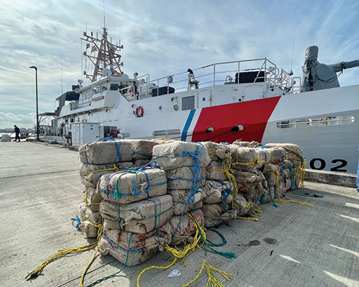
U.S. Coast Guard photo
Maritime borders pose very specific, complex, and nuanced challenges for governments around the world, according to Jorge Ramirez, managing director for the Americas of Travizory Border Security. “However, the majority of countries do not have the right tools — whether that be human resources, technology, skills or time — to properly oversee and protect their marine territory effectively,” he says. “From cruise ships and leisure yachts to cargo ships, fishing vessels and other private boats — the sheer variety of travelers, operators and vessels makes navigating sovereign waters incredibly difficult and the size of many countries’ marine territory can be unwieldy.”
New risks arise almost overnight, from piracy to drug trafficking, observes Ramirez. “Without a comprehensive security system to anticipate and adapt to these sophisticated threats, countries are left vulnerable and unable to take appropriate action against risks such as illegal fishing, illegal immigration, and smuggling of contraband,” he says. “The past two years have also shown how important border security can be in the fight against the pandemic, as secure maritime borders are a keyway to minimize the risk from infected individuals who plan to disembark at the destination country.”
Security Challenges and Risks

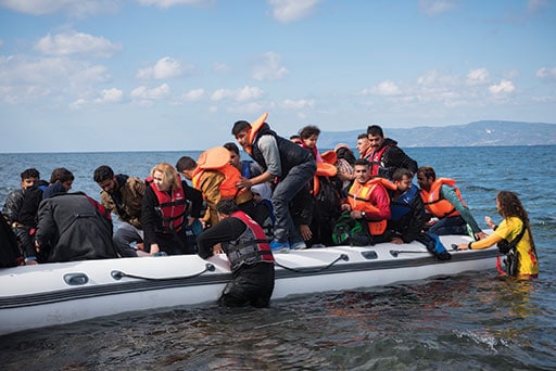
Aymeric de Cagny, naval business developer at HGH, observes that in relation to maritime security, most of the concerned countries are currently facing risks such as illegal trafficking (drugs especially), illegal immigration with possible shipwrecks, and intrusion into ports or naval bases,or into critical infrastructures. “Our systems are designed to improve the surveillance of maritime borders, thanks to panoramic systems like thermal radars with video analytics capabilities,” he says.
According to a spokesperson for Thales, the nature of conflict has been constantly shifting from intra-state wars in the post-Cold War era to asymmetric threats at the turn of the 21st century.
“Threats may be coming from swarms of fast manned and unmanned surface boats, from submarines and unmanned underwater vessels, and from manned and unmanned aerial vehicles, in different combinations. Carrying any type of mission in such complex environments can therefore be very risky for forward deployed assets,” says Thales.
Traditionally, territorial waters are monitored by Navy or Coast Guard vessels designated to perform surveillance and reconnaissance missions, affirms Ramirez. “However, the number of available policing vessels are often limited and therefore can be limited in effectiveness against ever evolving and increasingly sophisticated enemies,” he says.
Innovative Technologies
Recognizing current vulnerability, countries around the world have started focusing on upgrading their maritime security capability, and this has included investing in innovative technologies to tackle current threats, affirms Ramirez. “More and more we are seeing the use of GPS satellites around the world, providing accurate vessel location and tracking while richer nations are embracing satellites to perform reconnaissance of unidentified vessels with radars and extremely powerful cameras,” he says.
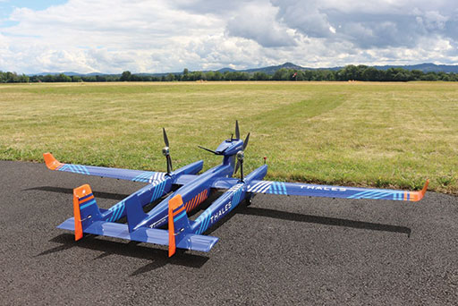
Indeed, to protect their crews, capabilities and borders, armed forces have increased investment to strengthen target detection, identification, and surveillance, affirms Thales. “Multi-role helicopters — smaller, lighter than their combat counter-parts — but also, increasingly, small intelligence surveillance and reconnaissance (ISR) platforms, including unmanned systems, are now at the forefront of these missions where every kilogram on the platform counts,” says Thales.
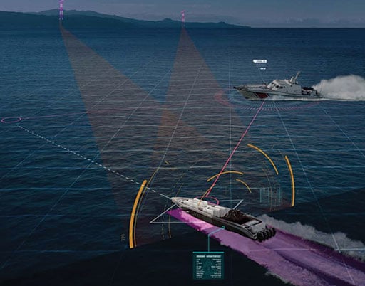
The heart of target detection, identification and surveillance missions is the ability to operate in any type of environment and in any weather conditions, according to Thales. “From illegal fishing to piracy and smuggling, national authorities must be able to keep a close watch on their waters, any time and in any weather conditions not only to ensure exclusive economic zone (EEZ), but also ensure homeland security at sea,” says Thales.
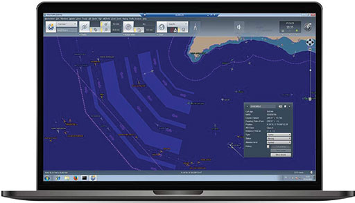
Usual means of surveillance, such as patrol vessels and aircraft, are becoming an increasingly limited resource particularly when often large-scale areas need to be monitored, observes Airbus DS.
“Satellite systems provide complementary information to optimize the cost of operations at sea and enable much larger areas to be effectively monitored,” Airbus DS says.
A peculiarity of satellite imagery and derived services and systems is that they have no geographical limitations, points out Airbus DS. “They can monitor and acquire imagery and intelligence from both onshore and offshore in national territories and beyond, providing full situational awareness,” Airbus DS says. “With the benefit of not only being cost-effective, satellite technology can also provide near real-time insight to support emergency situations and operations — with imagery being made available within just a few hours of tasking. The mix of optical and radar information can enable effective monitoring offering the ideal combination between coverage and resolution.”
“Satellite systems provide complementary information to optimize the cost of operations at sea and enable much larger areas to be effectively monitored,” Airbus DS says.
Concerning weather, coastlines are famous for their frequently changing weather, highlights Thales. “Sunshine, rain, wind and storms can often all take place within the space of a day, affecting not only skies but also sea states. The disadvantage of the X band is that it is particularly sensitive to rain, which degrades the detection range of radars operating in this band,” says Thales. “To address this, our CoastWatcher 100 features antenna polarization switching. By enabling operators to choose between linear and circular polarisation, we ensure that the CoastWatcher 100 continues to deliver optimal surface detection, whatever the weather.”
New Features
The past few years have seen the capabilities of countries, and private companies, advance with major developments in vessel tracking and location technology, affirms Ramirez.
“These solutions are being leveraged in incredibly innovative and unique ways around the world and we are seeing more and more third parties start to enter the market, providing security services to governments and private entities,” he says.
Throughout new developments, some specific features significantly improve detection performance, according to de Cagny. “Automatic functionalities are implemented in order to provide the user with the most pertinent information. In this sense, artificial intelligence provides automatic shapes recognition and classification. This helps the operator analyze thermal detections,” he says. “Communication from the deployed system to a centralized control room is a key for a good situational awareness. Centralization of the data allows to cross-analyze multiple data sources and deduce a higher-level information. One of our CYCLOPE software features is the understanding of trafficking patterns to recognize behaviors. This supposes to detect automatically and repeatedly trafficking vessels for instance.”
According to Ramirez, there is still a wide gap between the security protocols of the sea versus those of the air.
“Critically, information about what else the ship is carrying, such as people on board, is not collected or analyzed to the same degree. Naturally, this poses a significant risk to the national security of a country,” he says. “If we take the pandemic as a microcosm of the wider maritime security challenge, we can clearly see that information about passengers (whether that be visitors, citizens, or migrant workers) plays a central role in fighting threats.”
Understanding the travel patterns of different passengers is also vital to the effective security of a nation, observes Ramirez. “Some visitors may arrive on a cruise ship, disembark and depart the country via airplane while migrant workers may arrive via air and proceed to travel to a ship or boat. With this level of cross-over, it is vital that the two systems speak to each other and do not operate in silos,” he says. “Our API-PNR targeting system updates in real-time and makes sure no one slips through the cracks – encouraging collaboration and cross-departmental communication to identify risks from any direction or source and dramatically elevating the security and control in the maritime sector.”
Predictably, technological advances are key to maintaining a strategic advantage, according to Thales. “Smart radars such as those we develop in the frame of our Master family can make a real difference. Smart radar applications are dedicated to facilitate crew workload,” says Thales. “Those new functionalities drive operator asking his radar to present a comprehensive view of the environment and raise all the abnormal situation on the area.”
Airbus has developed STYRIS to help enforce border integrity. “The product is dedicated to maritime surveillance and traffic monitoring, aimed at improving the safety of navigation as well as enhancing global security of the maritime domain. STYRIS combines surveillance stations with network sharing information between stations and also supports the coordination for the deployment of enforcement units,” says Airbus DS. “STYRIS automatically displays vessel information gathered by different sensors and sources of information on the operator’s screen. Vessels that do not follow procedures, or small/fast moving boats, will require more attention and can be alerted to patrols for further investigation if deemed as suspicious.”
It’s All About Technology
Indeed, technology is developing to manage the newer security risks being experienced by countries globally. In the second part of this story we’ll review the aspects of manned and unmanned coastal surveillance technologies and the role of big data and artificial intelligence.
